Yesterday I formed the determination to get to the top of Guadalupe Peak today. I had several reasons. I had made almost 1/3 of the altitude gain with little problem on Wednesday, but turned around because I thought I was on the wrong trail. I had done very little in the way of exercise during the rest of the week. And I got the idea in my head that today was the right day because tomorrow I will turn 62 years old. It just seemed somehow appropriate that I had been born at one of the lowest altitudes in Texas in Corpus Christi and would celebrate the last day of my 61st year at the highest.
Alas, it was not to be. But I'm ok with it. It's actually kind of funny.
The first thing I did was wake up to the howling that signals high winds. This was not supposed to happen! The forecast didn't say WINDY until tomorrow! So I looked at TWC online to see just how fast they were blowing. 22 mph. Well, that's not so bad, is it? I stepped outside with Budd as he left for work just before 8 a.m., quite breezy, but not cold, in spite of the temperature showing at 35 degrees. OK, I'm going to try it, but I'll be prudent. I'll stop at the Visitor Center and ask a ranger whether it is too dangerous.
Rushing around to get my breakfast and prepare my pack for an 8-mile hike, I left the house at ten minutes of nine and drove to the VC. Asked the first interp I saw, a fit-looking young man, about the winds. 'Naaaah,' he says. 'We don't worry about the winds until they're gusting above 55 mph. You should be fine. Lean into the mountain, make sure you have a hat strap (I didn't) and plenty of water, because the wind will dry you out. You'll be fine.' Since I didn't have a hat strap, I would have to take off the hat, but he told me to take it with me for the calm spots. There's no shade to speak of on the trail.
I got back in the car, applied sunscreen and drove to the campground, where I put my hat in my pack, turned on Bigmouth, signed the trail register and headed back up the same trail I had been on day before yesterday, which I had determined was indeed the right trail. I was very pleased that even with the wind I made the point where the sign was located (see Wednesday's blog for the picture) in under 45 minutes, as my 9 a.m. BodyBugg alarm hadn't gone off yet. I made the sharp right turn where I had turned on Wednesday, and soon realized I had passed my previous turnaround point without recognizing it. I was on a previously untraveled (by me) track that led back into the canyon.
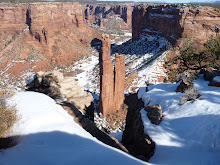
In the harsh morning sun I didn't find anything I was particularly interested in photographing, so unfortunately there are no pictures to document this hike. Just as well...I wasn't going where I thought I was going. It soon became apparent that I was going steadily if not steeply downhill. I kept thinking that any minute the trail would turn upwards. Because the trail followed on the same side of the mountain as the wash where Devil's Hall trail wanders, I assumed that somewhere back in the canyon it would begin ascending from the west. Because it was only slightly downhill, it was fairly easy walking, except for the times I felt I didn't want to be moving as a gust of wind caught me. At those times, I'd plant my stick in front, take a wide-legged stance and wait it out. I was quite stable, no chance of being blown off the side of the mountain.
Before very much longer, I was getting a little agitated. I hate to lose altitude when I still have quite a bit to gain, so I was not liking the downward trend on this trail. Suddenly, I spotted a sign up ahead. Good! I'd be able to orient myself from here. Striding the last few yards, I eagerly looked at the sign. What?! Guadalupe Peak back the way I had come, Devil's Hall straight ahead...how the heck? I had found the sign that I remembered on Wednesday (except there was no Tejas trail access to the right), but where had I gone wrong? I hadn't been anywhere near the summit on Guadalupe Peak.
Now I had a decision to make. I had come quite a ways DOWN, on the wrong trail, when the trail I wanted was already an 8.5 mile trek. That's longer than I've gone before. Should I climb back up, looking carefully for where I missed the turn I should have taken? I sat down to take off my pack and consult the map. That's when I remembered I had taken the map out of my pack on Wednesday, to try to figure out what I had done after I got home. I hadn't put it back.
Discretion became the better part of valor as I turned back to the east on the return trail to the campground. I was disappointed, but there were just too many things working against me to correct my mistake today. Not only the wind and the lack of a map, but an extra two miles? Not gonna happen.
As I strode along, making great time on this trail, I decided to take Bigmouth in to show the VC ranger, and make sure I knew what I was doing next time. Oh, yeah, there will be a next time! I'm not letting this defeat me. I got to the VC, walked up to the big map on the counter and found it...Bigmouth's trackback was a perfect match for, wait for it--THE HORSE TRAIL! I finally know where that guy came from! (Wednesday's blog again.)
I was home in time to have lunch with Budd, but I have every intention of taking that hike on the next low-wind day. The two and a quarter miles today took only 2 hours and burned 688 calories! I'm getting there,
Now I think I'll cross-stitch all afternoon--I've earned it!
Subscribe to:
Post Comments (Atom)
No comments:
Post a Comment