If you are a regular reader, it can hardly have escaped your notice that Budd and I are closing a chapter of our lives and beginning a new one. As I edited this blog to print out for my mother-in-law's Christmas gift, I felt a lot of emotions that I hadn't expected. Gratitude that we had this opportunity for a travelling adventure, joy about some unexpected discoveries, coming to peace with the notion that I'm not going 'home', and our hometown may be several hundred miles away from all of our kids and grandkids for the foreseeable future.
Once again, yesterday (Christmas Day), I found myself looking back. One year ago, on Christmas Day 2009, we also didn't have a tree to speak of. We were preparing to move and basically going into the unknown. Since we would be placing all of our possessions, save a few that we would have with us, in storage, our home was full of boxes. Decorating seemed not only futile but foolish. I took out a little artificial miniature evergreen tree in a gold flowerpot, with gold decorations and ribbon on it, and that was our tree. Under it were our gifts to each other, something small and practical, I don't even remember now what they were.
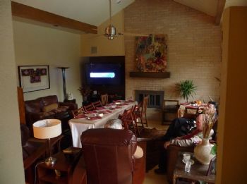
Our house had always been the gathering place. I always cooked the Christmas feast, and we always had the kids and grandkids open their gifts from us under OUR tree. This was tradition. Last year, all was topsy-turvy. My kitchen was virtually packed up already, just a few pans I was taking with me and one set of dinnerware left out for our last few days. We gathered with the other kids at the home of one of my daughters. That was convenient, as both of my sons were living there at the time, and all of the grandkids were there--my daughter's five, and my two boys' three. Only my other daughter and her husband were missing, and not for long. In a much smaller house, my four kids, spouses to two of them and eight grandkids, plus my son-in-law's mother and us, and for a few minutes his aunt and her grown kids, all found a spot to perch among the wrapping paper, bows and scattered toys to eat a dinner I didn't know my daughter knew how to cook. It was wonderful!
Within a few days after that, the rest of our possessions were packed and our two sons and two sons-in-law had made relatively short work of transferring everything to two big storage units, side by side in an indoor facility. We were left with just slightly too much to pack into my husband's '92 Ford F150 and my Buick Century. In a raging blizzard, we crept downtown to pick up a small U-Haul and arrived just minutes after they closed. I was determined that taking our lives in our hands in that blizzard would not be in vain, and finally caught the eye of one employee who was wrapping up the paperwork for the night. He took pity on us, and we drove away with the trailer. The next morning, I raced around to stores trying to find a hands-free set compatible with my husband's cell phone so we could be in contact while we drove the 485 miles to our first destination, Chinle, AZ and Canyon de Chelly. Meanwhile, Budd unpacked the pickup and repacked everything into the trailer, adding the items that wouldn't fit before. We set out for the unknown on Dec. 31, 2009, and the rest is history, as they say.
On Dec. 31, 2010, we'll set out again, travelling much lighter with just the Buick--we left everything else in storage last time we dropped by Salt Lake to touch base. This time we know a little bit about what to expect. We've lived in the area for a month on an assignment earlier this year. We know where to find the stores we like, a little bit about what neighborhoods are like, and exactly where DH's office will be-just across the street and a block south of where we lived in August. We hope this new adventure will last longer than a year, though we've both remarked how perfectly it worked out for the current one to last exactly a year.
And we both hope we won't get bored, staying in one place. Maybe next Christmas will find us saying, 'we really need to get on the road again'. We'll see...
Sunday, December 26, 2010
Thursday, December 16, 2010
December 15, 2010
Wednesday, December 15, 2010
About the time I finally got it through my head that the Forest Service is going to pay for moving our household goods and furniture, which was amazing enough, Budd received an email with the paperwork. We are to fill it out and fax it in, then a coordinator will call us, the request will be refined, and Budd will sign the final paperwork for it.
Guess what's on it? A HOUSEHUNTING TRIP!!! To say this solves all my problems would be a slight exaggeration, but WOW! It solves a lot. We won't have to rent a house unseen, which means agents will work with us. There's even a potential that an agent who specializes in relocation will be assigned to us to help us narrow it down before we get there.
Oh, about that 'we', it may be that only one of us gets to go. That would be me. The last time Budd acquired a home for us without me, the result was a disaster with far-reaching consequences. I'm not blaming him, he just didn't have a clue what warning signs to look for in a big city, and the choices were limited anyway. That was over 20 years ago, and I’m sure he would do a fine job now. But if I can go and he can stay and work, that's better for the finances anyway. We'll find out soon. I can wait....for a minute.
Every silver lining has it's cloud, though. Isn't that the way the saying goes? This isn't a very big cloud, but...I don't have a coat with me. I never got back to Salt Lake after the weather started turning, so my winter clothes (which no longer fit me anyway) are stored there. We haven't needed much in the way of cold-weather gear here. I have a light quilted jacket. I guess I get off the plane in layers topped by that and go straight to Ross or Burlington to buy a heavy coat, the likes of which they don't even carry in the stores here. And mittens. And a knitted hat. And snow boots...well, you get the picture. OK, cloud dispersed.
To say we have a LOT to be grateful for would be no exaggeration at all. We never dreamed that things would come together like this. New job, wonderful. Paid move, outstanding. Househunting trip? Nothing short of incredible!!!
This is me:
Tuesday, December 14, 2010 (Catching up again)
To begin, with no apology whatsoever I quote myself from something I posted on a friend's blog that got me thinking about the day I'm about to start.
"Have you ever seen the movie "Fast Forward"? We watched part of it again just a few days ago, and yesterday Budd asked me, if we had one of those remotes, wouldn't you honestly fast forward about three weeks right now? A few years ago I would have told him yes. Even now I have to restrain myself from wishing away the few days until Christmas. I think what made the difference was surrendering myself to the concept that I can't control everything in my life."
I have to confess, though, that I haven't entirely surrendered. That occurred to me shortly after I clicked the 'submit' button. Like a millisecond. Because if I could control everything in my life, I'd certainly be pointing that remote at Budd right now to have him make up his mind about the logistics of our move.
I once made a study of something called Human Dynamics. The authors of the theory stated that something you and I have always thought of as personality differences are actually differences in cognitive processing--how our brains organize information on a moment-to-moment basis. Although I hated being placed in a neat little box, I have to admit that understanding the theory has served me fairly well over the years, and by the way has kept me from allowing the violent little control freak inside me from murdering poor Budd.
You see, we have similar processes to a certain extent. In the parlance of the HD theory, he is a physical-emotional thinker, and I'm a physical-mental. What that comes down to in a process like what we're going through right now is that we both gather facts--lots and lots of facts. He gathers them like you would gather apples in a basket, throwing them all in together and continuing to gather as he tries to decide which delicious apple to eat. I gather them into sorting bins. As I pick up each one, it goes into a compartment based on size, degree of ripeness, variety and whether or not it has blemishes. When I have what I consider enough apples, I have them all sorted and know exactly which one I'm going to eat. In fact, as soon as I have picked up the perfect size, variety and non-blemished ripe apple, that's when I've gathered enough.
If that metaphor wasn't too extended and labored, you'll know that means that Budd can't make up his mind, and it's driving me bonkers! Should he extend his commitment here until January 7 to minimize the time between jobs without pay? Should he make an attempt to get back to Canyon de Chelly for that week instead, which had been in the plans before he got the new job? Should he listen to his dear wife and understand that we need both of those weeks to take care of moving business? If so, should we go to Salt Lake to prepare and then go to Denver, necessitating a housing decision by long distance, or should we go to Denver first, secure the housing, then go to Salt Lake? Or not go to Salt Lake at all?
Just decide, and I'll adjust. But I have to have a decision from which to base my planning. The upshot is that I'm running around in circles and half the work is wasted. Yesterday's discovery that 90% of the property management companies won't allow us to sign a lease sight-unseen may legislate in favor of the Denver first decision, but if he decides to work an extra week, I just don't see how we get everything done before he starts the new job. The fact that I'm limited in my driving time by acute highway hypnosis--I go to sleep--means that I can't do it without him to at least drive me places...
Yep, maybe I could use that remote after all.
P.S. Does nervous energy burn calories?
Tuesday, December 14, 2010
December 14, 2010
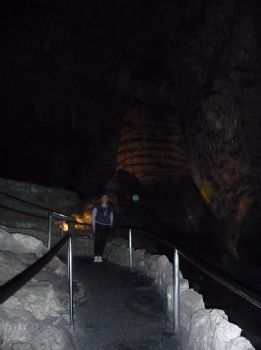
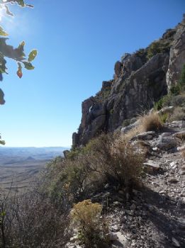
On Sunday we went back to Carlsbad Cavern to do the hike we had planned for Friday but couldn't complete due to our late start. I've never been so glad to have my plans interrupted as I was on Friday, but I did still want to enter the cavern from the natural entrance and hike the 3 miles to tour the main trail.
When I was nine years old (I had always thought eight, but my mother says nine), my family, all but my sister who was a baby of one at the time, toured the cavern. In those days all tours were ranger-led, and everyone took the natural entrance. From that entrance, the trail drops steeply for one and a half miles or so, descending about 800 feet into the maze of intersecting caves. Then it rises about 40 feet to enter The Big Room. Those who take the elevator down nowadays pass where the trail enters shortly after leaving the underground restaurant/gift shop area at the lower end of the elevator. From here, the trail skirts the side of the huge room, travelling in a counterclockwise direction for another mile and a half through some of the most beautiful, spectacular features in the main area.
I have little memory of the tour when I was nine. What I do remember tells me that we walked forever, I held my mother's hand for part of the way, and that at some point we stopped for a while, my mother dropped my hand to do something for my little brother, and the lights went out. I was petrified, afraid to move for what seemed like an interminable time. There is no light whatsoever that deep into the cavern, and my memory's impression was that there was a drop-off just beyond the handrail. Because I was small and the handrail was not adequate to keep me from slipping through, I was terrified. I have always attributed my claustrophobia to this experience, as I don't recall being afraid of the dark or of confined spaces before that.
Now for reality...that stop was always made in front of the formation called "Rock of Ages". At that spot, the lights were turned out and the ranger led the tour in singing the old hymn of that name. Of course now that can't happen, and the tour is self-guided anyway. But I've visited the spot twice in the past 72 hours and I now know...there is no drop-off, or anything that could have been interpreted as a drop-off in that location. Strange what a child's perceptions can do to the adult's memory. So I faced my nemesis, here's proof:
By the way, this is an active cave, and a number of the pictures have artifacts like the large white circle over my left shoulder that I think are drops of water that caught the flash.
Now, that formation is near the end of the hike we took today--these pictures aren't in chronological order this time. Budd had the camera, except for the spot near the entrance where I asked for it to take this picture. Duck!
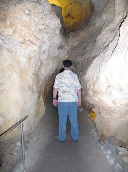
There were several spots where he had to, and not one had a warning sign!

He took a couple hundred pictures, some that were absolutely spectacular. However, it's impossible to put all of them here, and I haven't been through them enough to choose a few samples. So I picked a few that had me in them for your entertainment.
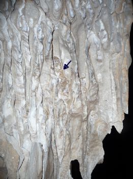
In this next picture, Budd wanted me to stand by the speleothem to give some height perspective. While I was waiting for the flash, a feature of the formation that I hadn't realized before caught my eye. The inside of these 'draperies' are crystalline!
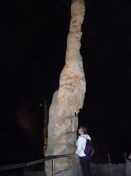
Once Budd had as many shots as he wanted, I called him over and asked for a close-up. Though it's spectacular, this picture didn't do the crystal justice. The arrow points to the one I was looking at.
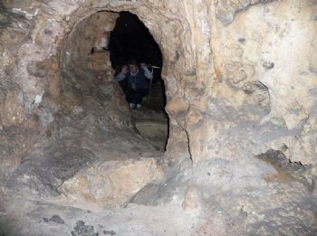
The final one caught my eye as people ahead of us disappeared around the corner and then their legs appeared in the window. I had Budd stay behind and went around to play peekaboo with him...
When I've had a chance to sort through the rest, I'll post some on a Facebook album and post a link here. We covered the three miles total hike in right at 3 hours, thanks to long stops for Budd to get his photos. But even though I'll share, I have to say that no photo can capture the sheer wonder of this place. Everywhere you look, spectacular sights greet you. Words can't convey it either, you have to be there. I'm so thankful I got to see it again as an adult, as my childhood memories didn't do it any kind of justice.
When I was nine years old (I had always thought eight, but my mother says nine), my family, all but my sister who was a baby of one at the time, toured the cavern. In those days all tours were ranger-led, and everyone took the natural entrance. From that entrance, the trail drops steeply for one and a half miles or so, descending about 800 feet into the maze of intersecting caves. Then it rises about 40 feet to enter The Big Room. Those who take the elevator down nowadays pass where the trail enters shortly after leaving the underground restaurant/gift shop area at the lower end of the elevator. From here, the trail skirts the side of the huge room, travelling in a counterclockwise direction for another mile and a half through some of the most beautiful, spectacular features in the main area.
I have little memory of the tour when I was nine. What I do remember tells me that we walked forever, I held my mother's hand for part of the way, and that at some point we stopped for a while, my mother dropped my hand to do something for my little brother, and the lights went out. I was petrified, afraid to move for what seemed like an interminable time. There is no light whatsoever that deep into the cavern, and my memory's impression was that there was a drop-off just beyond the handrail. Because I was small and the handrail was not adequate to keep me from slipping through, I was terrified. I have always attributed my claustrophobia to this experience, as I don't recall being afraid of the dark or of confined spaces before that.
Now for reality...that stop was always made in front of the formation called "Rock of Ages". At that spot, the lights were turned out and the ranger led the tour in singing the old hymn of that name. Of course now that can't happen, and the tour is self-guided anyway. But I've visited the spot twice in the past 72 hours and I now know...there is no drop-off, or anything that could have been interpreted as a drop-off in that location. Strange what a child's perceptions can do to the adult's memory. So I faced my nemesis, here's proof:
By the way, this is an active cave, and a number of the pictures have artifacts like the large white circle over my left shoulder that I think are drops of water that caught the flash.
Now, that formation is near the end of the hike we took today--these pictures aren't in chronological order this time. Budd had the camera, except for the spot near the entrance where I asked for it to take this picture. Duck!
There were several spots where he had to, and not one had a warning sign!
He took a couple hundred pictures, some that were absolutely spectacular. However, it's impossible to put all of them here, and I haven't been through them enough to choose a few samples. So I picked a few that had me in them for your entertainment.
In this next picture, Budd wanted me to stand by the speleothem to give some height perspective. While I was waiting for the flash, a feature of the formation that I hadn't realized before caught my eye. The inside of these 'draperies' are crystalline!
Once Budd had as many shots as he wanted, I called him over and asked for a close-up. Though it's spectacular, this picture didn't do the crystal justice. The arrow points to the one I was looking at.
The final one caught my eye as people ahead of us disappeared around the corner and then their legs appeared in the window. I had Budd stay behind and went around to play peekaboo with him...
When I've had a chance to sort through the rest, I'll post some on a Facebook album and post a link here. We covered the three miles total hike in right at 3 hours, thanks to long stops for Budd to get his photos. But even though I'll share, I have to say that no photo can capture the sheer wonder of this place. Everywhere you look, spectacular sights greet you. Words can't convey it either, you have to be there. I'm so thankful I got to see it again as an adult, as my childhood memories didn't do it any kind of justice.
Saturday, December 11, 2010
December 11, 2010
Since the events of the last blog, our world has changed entirely again, and this time it has been cause for wild celebration!
On Monday of this week, Budd had an interview with a committee from the US Forest Service, Job Corps division. The job he had applied for was a help-desk position, and he found out during the interview that if selected he would be supporting 28 Job Corps sites all over the U.S., from Golden, CO. When he returned home after work I asked him how the interview had gone, and he said he thought ok. We didn't discuss it any further, we've been here before. They had told him it would be 2-3 weeks before a decision would be made.
Instead, our discussion centered on our Christmas plans. With his hours for this seasonal position drawing to a close, he didn't want to take a week off and go to Salt Lake. We'll miss our kids terribly--this is the first time since I started having kids that I wasn't with at least some of them, and now grandkids, for Christmas. But it's just too impractical to get there and back. It's a 3-day drive for us with short days (we're both night-blind), and then 3 days back.
Tuesday, Budd received an instant message from his supervisor at Timpanogos Cave (his home park): call me. As soon as he could, Budd gave him a call and received some startling news. The hiring committee from the previous day's interview had called to check references, and told him that Budd was their top candidate. Now we're on pins and needles, but still expect to hear in 2-3 weeks. We know there's a process involved, and it doesn't go fast, especially at this time of year.
Yesterday, we had a Carlsbad Cavern tour planned. Budd had business in town, and had received permission from the superintendent here to take me with him and do the tour on work time. One of the great perks of the Park service is that employees, even those who aren't rangers, are expected to be knowledgeable about the parks, and are given time off with pay to explore when it's practical.
I was waiting for him to return from what he thought would be about two hours' worth of work before we could go, when the phone rang. The voice on the other end identified the caller as a Job Corps staffer, and wanted to talk to Budd. I was so agitated that I failed to get her name to write down, or her phone number! I just gave her Budd's work cell phone and started to pace. Fifteen minutes later, Budd called and told me that he would be late for our trip. He needed to get some paperwork to the Job Corps HR staffer that proved he had worked for at least a year at his current rating, and then they could offer him the job! In the middle of everything, the local phone company showed up for a trouble call Budd had placed two weeks ago. What a zoo!
I couldn't believe my reaction to this news. First, of course, I whooped and yelled and danced around the house. At long last, after more than two years of applications, 18 months of uncertainty while working for the Park Service, and just over a month away from unemployment, a permanent job is his! Not only a permanent job, but one of the best work situations he has applied for, and in a location we are happy with. Then, much to my surprise, I started shaking and dissolved in tears! After a few minutes, I got myself under control and started whirling around the house again.
By this time, we were quite late for our day's plans. I decided we would probably stay overnight in Carlsbad so we could celebrate our good fortune, and got out the suitcase to pack. I had no sooner finished getting my items into the bag when Budd blew in the door and we collided for a hug and screamed a little more together. Now it was 12:15, and we decided that we'd do the cavern tour on the way into town. Both of us grabbed a quick bite to eat, he threw his things into the bag and by 12:30 we were in the car...
Which wouldn't start! The battery was completely dead, all we got was a click. Budd jumped out of the car and cleaned the terminals, but still no luck. So he dug into the trunk under the spare for our jumper cables, and soon had it started, thanks to bringing home his work vehicle (usually a no-no). Off we went, sailing down the highway for a full mile before he remembered he hadn't rotated the backup drives. We had to turn around.
Now we were playing phone tag with the IT person at Carlsbad, who had arranged our tour. Budd left her a message, then she left him a message. Which said that the last tour leaving through the natural entrance of the cave was at 2 p.m. It was now 1:15, and the turnoff to the Cavern is 40 miles away. I said, 'Let's try to make it,' then had to specify that I didn't mean by doing 75 in a 55 zone. Budd slowed down 'til we were out of the park and the limit was in fact 75. We got to the visitor center 2 minutes late.
We did do part of the tour, going down the elevator to save some time, only to discover that I had left the SD chip in the slot of my home computer, and hadn't brought a spare battery. When we came to the fork in the cavern trail that was a short-cut back to the elevator, we called it a day, promising ourselves to come back on Sunday (tomorrow) for the natural-entrance tour. With my hiking habit, this will be far more satisfactory to me--I just hope his hip will take it. That's been sore from some unaccustomed crawling under desks and climbing ladders to disconnect and reconnect computers during a re-carpeting project at Guadalupe's visitor center.
Last night we had dinner at a restaurant that has been created in the last year in a historic building in Carlsbad. The Trinity Hotel and Restaurant has a fascinating history, including a robbery in the bank that used to be in the building--by none other than Bonnie and Clyde! The food was excellent, as was the service. I had grilled salmon with a champagne chablis sauce and steamed vegetables. We shared a goat cheese appetizer that had been drizzled with blackberry/habanero sauce, delicious and spicy! Following that with a delectable tiramisu, we rolled out of the restaurant looking for live music, which was not to be found in Carlsbad last night. Oh, well.
And now I'm here, finally caught up for the last three week's events, and looking forward to that Jazz game at Mavs in a few minutes.
We've got a lot of logistics to work out in the next couple of weeks, but there's nothing we can do about it right now. I'm ready to relax!
December 2, 2010 (Last catch-up blog)
Today's venture was planned for new territory--Bear Canyon--that branches off in the middle of the Foothills-Frijole Loop I did over a month ago. I didn't feel the need to get all the way to the top, and promised Budd I would turn around at 2 p.m. no matter where I was, to be sure I was home well before dark. The Bear Canyon trail is 1.8 miles from the turnoff to the top, where it joins the Tejas trail, the major East-West trail that traverses the park. It is rated strenuous.
From the outset this hike was weird for me. I planned to do it yesterday, then let the forecast persuade me to put it off until today, which was supposed to be in the low 60s. Then I left late, leaving the house around 11 am. I went first to the Visitor Center to mail a birthday card to a grandson and check their large-scale map for distances, because it shows the distance of each segment of the trail. I wanted to know which end of Frijole trail to approach from, so I could save my legs and my energy for the strenuous part after the Bear Canyon trail turns off. I determined that it was best to start from the trailhead at Frijole Ranch, and then let the interp persuade me to see if I could check out a radio (no), so I think I actually got on the trail about 11:30 a.m., or maybe just a little earlier.
It's been a week of rest and a massage since I wore myself to a nub on Guadalupe Peak trail. You'd think I'd be ready. But even the familiar 1/3 mile from the trailhead seemed to tire me more quickly than it should have. Not to mention the heat! Even on a 55-degree December morning, the sun is HOT at 5500 feet. It was far to the south, so I knew when I turned west there would be shade from the canyon walls, but I was wishing for a short-sleeved T before I got to the first branch of the trail. Still, I pushed on, anticipating a cooler trek once I gained the canyon. Along the way I passed what looked like a shady oasis and thought about eating the trail lunch I had brought--a cheese stick and an apple. But it has become my habit to eat at the turnaround point no matter what time of day that takes me to, so I kept going.
The last time I had hiked this trail I was going in the other direction and I had on new boots. Now those boots have seen more than 30 miles of rough rocky trails--we're old friends. Each time I passed a familiar spot, usually where I had stopped and at least thought about taking a picture, I would think 'The turnoff is just ahead.' I was baking in the sun and really wanted to turn into that canyon where I thought I could stay under the trees in the watershed. Finally, I was right. I spotted the sign for the turnoff just ahead.
Turning west, I began to feel better about the whole thing. A new trail is always exciting, at least until you discover it wasn't the experience you thought it would be, which I did about a tenth of a mile along, when the trail turned south again and led up to what looked like the top of the ridge! This wasn't the plan...I thought I'd be hiking the watershed. Well, I guess that's either too rough or too ecologically delicate, because the trail skirted the south canyon wall far above it. At least there were times when the steep hillside and the vegetation growing on it afforded a little shade. At one switchback I paused to take a picture back the way I had come.
Looking ahead I saw an area that looked to be deep in the shadow of the mountain, where I decided I would turn around after eating. I knew the Frijole part of the trail was a 3-mile round trip, and that was enough for me. But because my 2 p.m. BodyBugg alarm hadn't sounded yet when I got to the shade, I decided to keep going until either the alarm went off or I reached the end of the shade. Which I did just a few yards further along. At that point, the trail crossed the watershed and continued back to the north side of the canyon, which meant it would be in sun all the way to the top. Nope, I was done.
I found a smooth rock and sat down to take off my pack. When I got the cheese out, I found that it had melted to a soggy semblance of its former self, but it was still good. Gobbled it down in three bites, ate my apple, and then got up for the return trip. But not before taking a picture of this outcrop for its interesting color pattern. It was directly above me.
Back I went the way I had come, making better time in spite of picking my steps very carefully. I was almost shuffling, which made my foot get high-centered on a fist-sized rock more than once. The trick is to pick the steps that won't result in a mini rock-slide. No radio, no sprained ankles, that was my plan!
Making it back to the relatively flat part of the trail shortly after two, I couldn't help but compare my condition today with the return trip from Guad Peak. Shoulders, sore from the pack. Knees, sore and stressed from steep downhill climb. Back, pretty tired. What the heck is going on here? The distance, as nearly as I could figure it from the Google tracking application, was a little less than half the Guad Peak distance, at 3.9 miles or so. The time was a little less than half the time, four hours almost exactly when I got back to the car. Why do I feel almost as tired?
I don't have access to a physical trainer or fitness instructor, so I found myself wondering--did I go too soon? Should I have waited a little longer for everything to fully recuperate before taking another steep climb? Or did I go too late, letting my conditioning fall below where I was last week with our long drive to Dallas and no exercise? The question may be moot anyway, as tomorrow and Saturday are the last nice days for at least a week if the 10-day forecast is to be believed. I don't think I could face a challenge that soon. And by the time the wind dies down again (if it does--I can't see beyond the 10 days) it may be too cold or I may be packing to move again.
This could have been my last hike for the year. I may be a little sad about that later, but right now it's ok.
December 1, 2010 (Catching up)
I got two emails today. One made me wistful and the other was a great surprise!
The first was from our friend who was our duplex neighbor when we were at Canyon de Chelly earlier this year (two different times). We became such good friends, and it was less lonely for me in this isolated spot because she was there. Fortunately for her, she has accepted another position in a different agency. Unfortunately for us, that means we won't see her when (if) we get back there, as today was her last day at Canyon de Chelly. Though we'll stay in touch, it won't be the same without her.
The second brought welcome and unexpected news that the tutoring service I freelance for has promoted me to the next step of the tutor hierarchy, from Tutor 1 to Tutor 2. This month is the first anniversary of my employment with them, so I guess it shouldn't have been a surprise. But I just didn't think about it. It means that I will be among the group that has first choice of the available hours in a three-day process of advanced scheduling each week, I'll be able to schedule more hours in advance, and it comes with a 15% raise--unheard of in this economy. I'm stoked!
I love the flexibility that this gives me for spending time on my other interests, as well as the fact that I can do it anywhere we happen to be as long as I have high-speed internet. The internet access is so expensive here (and we need it for Budd's job applications) that it's lucky I have this extra money to pay for it!
November 29, 2010 (Catching up)
It's fortunate for this catching-up process that I've been a little more faithful in blogging at my weight-loss site, www.SparkPeople.com. I'm copying these blogs almost verbatim from there in the interest of getting done and on to the interesting events of this past week. This is the account of our Thanksgiving trip.
And here's how it looked in the kitchen (nine visible, at least two behind me and myself, as well as three dogs underfoot somewhere):

This is really a wonderful way to celebrate the holiday as everyone brought at least one of their favorite Thanksgiving dishes. My sister-in-law is a fabulous cook, and her friends aren't too shabby. True to my habit for the past few years I skipped anything that wasn't one of MY absolute favorites, and had just a bite or two of each thing that was. I especially liked the fresh green beans and a mashed rutabaga dish became a new favorite. Of course the turkey, dressing and giblet gravy, some cranberry relish, just a taste of a sweet potato casserole (only because it had pecans on top) and corn pudding (only because my niece made it) and a devilled egg with jalapenos after Budd recommended them. A sliver each of pumpkin and pecan pie rounded out the meal after it had settled for several hours. I left behind several different varieties of stuffing, the mashed potatoes, most of the appetizers and several other kinds of pies, and didn't miss any of them at all.
I do have to back up and mention that as he showed us to the guest room, my brother, an avid Dallas Cowboys fan, remarked that he hoped it was ok if he put us in the room that he kept as a kind of memorial. Since I was looking at a picture of my father in his Coast Guard uniform on the dressing table when my brother said that, I made an assumption about the subject of the memorial room that soon proved to be mistaken. Looking up, I saw that he had taped up Cowboys logos and slogans all over the room, including on the tv and the headboard! It was all in honor of my husband, an avid Redskins fan. Later I returned to the room for some reason and found all the Cowboys logos gone, and a Redskins one taped on the headboard. Too funny!
The next day my sister-in-law insisted that I go and pamper myself because I had asked her where I might get a facial. Except for a miscommunication about how long things would take that made me miss lunch with the family, I loved my spa day. I had a massage, facial and manicure. Visited the rest of the afternoon with my mother, and then we went to dinner and a Los Lonely Boys concert with my brother and SIL. We had two standing tickets and four seats for six of us, and most of the seats went begging as we all stood and danced in place for two hours! Those guys put on a great show.
Next day found us packing to leave, but SIL made a wonderful pancake breakfast with oatmeal, banana and pecan pancakes. She also took me shopping in her closet, so I have four new-to-me tops and a pair of size 14 jeans that are well on the way to too loose, yay! Our last act before saying goodbye and getting in the car was to take the Redskins logo from the headboard and tape it, logo side out, in the window where passers-by could see it. But, fearful that my brother's house would get egged or tp'd, I whispered to my SIL what we had done, and drew a chuckle.
We spent the night in Odessa, TX and the next day we shopped for groceries at Walmart after eating at a breakfast place that must have been the only one in town, from the crowds. I also bought a pair of brown leggings to go with one of the tops, and a warmer coat, since all my coats are in storage in Utah because we didn't get to go home for winter clothes before coming down here. Loading our week's groceries in the trunk, we made it on home before dark.
I opened my email program and found an email from my brother: Your nefarious plot has been foiled. We found what you had done and removed it before our homeowner's association took offense. LOL! Unfortunately, before the week was out, their rivalry escalated when the Mavs beat the Jazz, also their respective teams. My brother's email said 'Mavs beat evil empire.' We are anxiously awaiting the rematch, hoping for a win so we can email him: 'Evil empire strikes back.'
November 23, 2010 (Catching up)
I seem to be forever apologizing for neglecting this blog, but that will soon be behind me. More about that in later blogs. This one is the account of my solo hike to the top of Guadalupe Peak, the highest point in Texas. The day after this hike, Budd and I got on the road to Dallas for Thanksgiving with my mother, brother and his family. Since then, events have speeded up to keep me forgetful, so I owe several blogs and will try to get them out before Christmas.
__________
Guadalupe Trail
The first .7 mile was familiar from my two previous attempts, but I felt sluggish and as if I weren't going as fast as I should. I stopped about a third of the way to the point where I had taken the wrong turn on Friday to talk to two gentlemen coming down the trail, a man and his 87-year-old father! As they approached and stopped, they asked if I were alone and how far I was going. When I told them, the older gentleman said "I'll bet you were a Girl Scout!" Delighted, I affirmed that I had been a Girl Scout. I was able to answer a few questions for them, during which two other parties passed, including a woman with her daughter, husband and dad, whom I would encounter again near the end of the trail. The woman mentioned a bridge on the trail, which she said was about halfway. I confided that this was my third attempt to reach the peak in a 7-day period. In better spirits after talking to fellow hikers, I continued and made better time.
Above the point where the horse trail split off, I found the right trail and marvelled that I hadn't seen it before. Thus began my long, long trek around the west side of this peak, during which time I saw no one travelling in either direction for quite some time. The trail switches back three or four times climbing up steeply, and across a ridge to the next peak to the west, then takes a long gentle rise around the north side again.

At the point where I took the right-hand picture, I had just passed a sign that said 'Cliff--Riders Dismount'. Most of it isn't very steep, but rises gently the entire time. It was probably around 11 a.m. when I came out high on the east side of the second peak travelling south, and started up the switchback that would lead me back around to the north and Pine Springs canyon side, then eventually around to the west of this peak also.


At this point I thought I was on the slopes of Guadalupe, but was not.
I was getting concerned that I hadn't yet seen a bridge and therefore wasn't halfway yet, when I met the first person I had seen coming down since the elderly man and his son. This young man had clearly spent the night at the campsite as his pack was almost as big as he was. He told me I probably was halfway, and that the bridge was considerably farther than halfway. Relieved, I kept walking and in short order met a young girl and several other men in quick succession. All of them had spent the night at the campground, which for some reason made me feel confident. No one who was doing the day trip had yet started back down. I did ask the first boy the time, and it was noon.
I had a particular point picked out as Guadalupe, but I kept comparing its height to the peak across the canyon, and finally decided that wasn't it. It's lucky I had already decided that, because when I finally spotted Guadalupe, I almost gave up. Here's the first glimpse--Guad Peak is the tiny knoll near the center.It was still so far away!

Just then another man came around a bend in the trail and stopped to ask how I was doing. He wanted to know if I thought I would make it, and I said 'I hope so!' I had already decided that if I didn't make it today, I wouldn't make it at all. He wished me well, told me that the trail was 'a little rough' when it came out on the south side of the mountain, exposed to the wind, and then said I looked like a brave lady. If I hadn't been so tired already, I might have questioned why he said that, but instead I just laughed and kept walking.
A few minutes later I overtook a family of four who were equipped for an overnight stay also. I greeted them as I passed where they had stopped for a rest, but didn't stop as I now heard another solo hiker behind me. The trail is so narrow in most spots that to allow someone to pass in either direction, someone has to step off the trail. However, it hangs on the side of the mountain in such a way that you have to go straight up or straight down to get off the trail...there isn't a shoulder. But a little further along, on a switchback corner, I gave up trying to stay ahead of the man behind me and allowed him to pass...his legs were much longer than mine.
Now the scenery was spectacular as I was high on sheer limestone cliffs punctuated with deep ravines full of ponderosa pine. I kept trying to capture this, but the ravines were in deep shadow. Eventually I passed the bridge
 , came to the point where the campsite trail leads off from the main trail, and knew that the peak was only a mile or so ahead. Each time it appeared from behind the trees or a bend in the trail it was like the mythical oasis in the desert...always as far away as the last time I saw it. And considerably above me! It looked like the last 1000 feet of altitude gain was going to be all in the last mile.
Now I began to pass people coming down from the peak as the trail switched back and forth rapidly. Among them was the family who had passed me as I spoke to the first two men, back near the trailhead. She said 'You're going to make it this time!' I replied 'If it KILLS me!', thinking that it might well do that.
Three switchbacks later, I almost gave up, even though I knew I must be within a quarter of a mile of the top. The trail led out on the south face of the peak and disappeared over a sheer drop or around a corner, I wasn't sure which. It was so frightening I wasn't sure I had the courage to step out far enough to see where it went, but I managed to creep forward far enough to see it. If I could edge around the corner, a huge boulder, then I would regain a reasonably broad path. Fortunately, the wind was not gusting at the moment or my courage might still have failed me. I sat down and scooted around that corner, though I'm sure younger or more intrepid hikers just strode across the rocks.
What followed was half an hour of sheer terror as I crept along the trail, sure that the wind gusts would blow me over at any moment. I was passed by at least two parties who seemed to have no problem, but each time there was a wind gust, I dropped to a squat and held on to the side for dear life. Am I afraid of heights? No, but I AM afraid of falling from them. I was supremely grateful when the trail led up and away from the edge, switching back slightly just once before winding up to the pinnacle, upon which sat a monument!
I was getting concerned that I hadn't yet seen a bridge and therefore wasn't halfway yet, when I met the first person I had seen coming down since the elderly man and his son. This young man had clearly spent the night at the campsite as his pack was almost as big as he was. He told me I probably was halfway, and that the bridge was considerably farther than halfway. Relieved, I kept walking and in short order met a young girl and several other men in quick succession. All of them had spent the night at the campground, which for some reason made me feel confident. No one who was doing the day trip had yet started back down. I did ask the first boy the time, and it was noon.
I had a particular point picked out as Guadalupe, but I kept comparing its height to the peak across the canyon, and finally decided that wasn't it. It's lucky I had already decided that, because when I finally spotted Guadalupe, I almost gave up. Here's the first glimpse--Guad Peak is the tiny knoll near the center.It was still so far away!
Just then another man came around a bend in the trail and stopped to ask how I was doing. He wanted to know if I thought I would make it, and I said 'I hope so!' I had already decided that if I didn't make it today, I wouldn't make it at all. He wished me well, told me that the trail was 'a little rough' when it came out on the south side of the mountain, exposed to the wind, and then said I looked like a brave lady. If I hadn't been so tired already, I might have questioned why he said that, but instead I just laughed and kept walking.
A few minutes later I overtook a family of four who were equipped for an overnight stay also. I greeted them as I passed where they had stopped for a rest, but didn't stop as I now heard another solo hiker behind me. The trail is so narrow in most spots that to allow someone to pass in either direction, someone has to step off the trail. However, it hangs on the side of the mountain in such a way that you have to go straight up or straight down to get off the trail...there isn't a shoulder.
Now the scenery was spectacular as I was high on sheer limestone cliffs punctuated with deep ravines full of ponderosa pine. I kept trying to capture this, but the ravines were in deep shadow. Eventually I passed the bridge
, came to the point where the campsite trail leads off from the main trail, and knew that the peak was only a mile or so ahead. Each time it appeared from behind the trees or a bend in the trail it was like the mythical oasis in the desert...always as far away as the last time I saw it. And considerably above me! It looked like the last 1000 feet of altitude gain was going to be all in the last mile.Now I began to pass people coming down from the peak as the trail switched back and forth rapidly. Among them was the family who had passed me as I spoke to the first two men, back near the trailhead. She said 'You're going to make it this time!' I replied 'If it KILLS me!', thinking that it might well do that.
Three switchbacks later, I almost gave up, even though I knew I must be within a quarter of a mile of the top. The trail led out on the south face of the peak and disappeared over a sheer drop or around a corner, I wasn't sure which. It was so frightening I wasn't sure I had the courage to step out far enough to see where it went, but I managed to creep forward far enough to see it. If I could edge around the corner, a huge boulder, then I would regain a reasonably broad path. Fortunately, the wind was not gusting at the moment or my courage might still have failed me. I sat down and scooted around that corner, though I'm sure younger or more intrepid hikers just strode across the rocks.
What followed was half an hour of sheer terror as I crept along the trail, sure that the wind gusts would blow me over at any moment. I was passed by at least two parties who seemed to have no problem, but each time there was a wind gust, I dropped to a squat and held on to the side for dear life. Am I afraid of heights? No, but I AM afraid of falling from them. I was supremely grateful when the trail led up and away from the edge, switching back slightly just once before winding up to the pinnacle, upon which sat a monument!

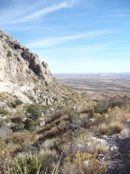
And here are a couple of panoramic views of the remains of the ancient lagoon that appear as lakes that are either dry or just under the surface, apparently salty.
This one is looking southwest toward El Paso.

This one is looking southwest toward El Paso.
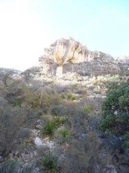
And this one more south. That's the El Capitan formation in the lower left corner, from above.

Here I sat at the base of the monument, took off my pack and dug for the food I had brought, some trail bars I had made quite some time ago and frozen. Whether my appetite was completely suppressed from my exhaustion or the bars freezer burned, they were dry and unpalatable. After forcing down one bite, I knew I couldn't eat more. Nor was my apple appealing. I decided to get started on the return hike with only one bite of food after 5 hours of hiking. At least I was drinking my water!
Starting down I was pleased to pass a family of five and then another party still on their way up. I like having people behind me on the trail for safety's sake. But they shortly overtook me, on the way back down already. I chatted a bit with the father of the first family as he tried to keep up with a son who looked about 12 and an adorable red-headed daughter he said was 7. His wife and a son in the middle were still some way behind for quite a while.
When my BodyBugg alert went off at 2 p.m., I had just started down. Now I knew I was in a bit of trouble. From high on the peak I had cell service, so I called Budd to let him know I would be late getting down, but would be past the scary parts before dark. I had to leave a message, which he didn't receive because the battery on his phone died as he was trying to retrieve it. By the time I made it down to the Guadalupe campsite turnoff, I was beyond tired and beginning to feel sore, and it was now 3 p.m. The sun winks out like someone pulled a switch at 4:45 at our house, but I still had more than three miles to go. I pushed as hard as I could, and was grateful that even in shadow there was still enough light to see the trail. However, I was berating myself for not having done the responsible thing two hours before and turning around before I reached the peak. I knew Budd would be worried when I wasn't off the trail before dark.
By a wild coincidence more than an hour later, I turned a bend in the trail and could see the campground parking lot far below just as Budd pulled up in his distinctively-shaped NPS vehicle and parked beside what I knew must be my car. It was full twilight now, and I had at least a mile, maybe a little longer to go. I was afraid he would immediately start up the trail, so I pushed even harder when it was safe to do so, hoping to cover the distance before he could get too far up and leave us both in the dark. What I didn't realize then was that he had already returned to his office for a couple of flashlights.
Finally, about a quarter mile past the confluence with the horse trail, I saw a dark bulk on the trail below me and called out his name. He answered 'hallloooo?' and ignored my suggestion that he stay where he was and let me come to him. We met just at the switchback corner, where he gave me a hug and took the pack from me. I went ahead on the trail feeling my way with my walking stick. He began to tell me how he had started up, encountering my friend with the little redheaded daughter who told him I was on the way down and doing fine when they last saw me. He pointed up the correct trail, but Budd turned too far to the left where the three trails came together, and took the El Capitan trail at first. After about half a mile he realized his error, backtracked and started up the right one. He had been on Guadalupe trail about half an hour by the time he found me.
At first I didn't want the flashlight, as I've always found the light from them to be treacherous on rough ground. But before long it was too dark to see the trail clearly and at one point I couldn't see which way to go. From there on we used the flashlight, Budd walking close behind me and pointing it ahead. By this time I was limping badly from the long day's hike, and any time I had to step down from a rock or step in the trail, I was landing hard with an oooph!, unable to ease myself down on my tired thighs. Budd took my hand and moved to the lead, and I leaned heavily on him for the last third of a mile. Believe me, I was grateful for him coming after me. I've been telling people he carried me down the last mile, but of course that's just a funny exaggeration. It couldn't have been more than half a mile.
Also for the dinner he cooked and brought to me on the couch, as I could barely move for the rest of the day!
Friday, November 19, 2010
November 19, 2010
Yesterday I formed the determination to get to the top of Guadalupe Peak today. I had several reasons. I had made almost 1/3 of the altitude gain with little problem on Wednesday, but turned around because I thought I was on the wrong trail. I had done very little in the way of exercise during the rest of the week. And I got the idea in my head that today was the right day because tomorrow I will turn 62 years old. It just seemed somehow appropriate that I had been born at one of the lowest altitudes in Texas in Corpus Christi and would celebrate the last day of my 61st year at the highest.
Alas, it was not to be. But I'm ok with it. It's actually kind of funny.
The first thing I did was wake up to the howling that signals high winds. This was not supposed to happen! The forecast didn't say WINDY until tomorrow! So I looked at TWC online to see just how fast they were blowing. 22 mph. Well, that's not so bad, is it? I stepped outside with Budd as he left for work just before 8 a.m., quite breezy, but not cold, in spite of the temperature showing at 35 degrees. OK, I'm going to try it, but I'll be prudent. I'll stop at the Visitor Center and ask a ranger whether it is too dangerous.
Rushing around to get my breakfast and prepare my pack for an 8-mile hike, I left the house at ten minutes of nine and drove to the VC. Asked the first interp I saw, a fit-looking young man, about the winds. 'Naaaah,' he says. 'We don't worry about the winds until they're gusting above 55 mph. You should be fine. Lean into the mountain, make sure you have a hat strap (I didn't) and plenty of water, because the wind will dry you out. You'll be fine.' Since I didn't have a hat strap, I would have to take off the hat, but he told me to take it with me for the calm spots. There's no shade to speak of on the trail.
I got back in the car, applied sunscreen and drove to the campground, where I put my hat in my pack, turned on Bigmouth, signed the trail register and headed back up the same trail I had been on day before yesterday, which I had determined was indeed the right trail. I was very pleased that even with the wind I made the point where the sign was located (see Wednesday's blog for the picture) in under 45 minutes, as my 9 a.m. BodyBugg alarm hadn't gone off yet. I made the sharp right turn where I had turned on Wednesday, and soon realized I had passed my previous turnaround point without recognizing it. I was on a previously untraveled (by me) track that led back into the canyon.
In the harsh morning sun I didn't find anything I was particularly interested in photographing, so unfortunately there are no pictures to document this hike. Just as well...I wasn't going where I thought I was going. It soon became apparent that I was going steadily if not steeply downhill. I kept thinking that any minute the trail would turn upwards. Because the trail followed on the same side of the mountain as the wash where Devil's Hall trail wanders, I assumed that somewhere back in the canyon it would begin ascending from the west. Because it was only slightly downhill, it was fairly easy walking, except for the times I felt I didn't want to be moving as a gust of wind caught me. At those times, I'd plant my stick in front, take a wide-legged stance and wait it out. I was quite stable, no chance of being blown off the side of the mountain.
Before very much longer, I was getting a little agitated. I hate to lose altitude when I still have quite a bit to gain, so I was not liking the downward trend on this trail. Suddenly, I spotted a sign up ahead. Good! I'd be able to orient myself from here. Striding the last few yards, I eagerly looked at the sign. What?! Guadalupe Peak back the way I had come, Devil's Hall straight ahead...how the heck? I had found the sign that I remembered on Wednesday (except there was no Tejas trail access to the right), but where had I gone wrong? I hadn't been anywhere near the summit on Guadalupe Peak.
Now I had a decision to make. I had come quite a ways DOWN, on the wrong trail, when the trail I wanted was already an 8.5 mile trek. That's longer than I've gone before. Should I climb back up, looking carefully for where I missed the turn I should have taken? I sat down to take off my pack and consult the map. That's when I remembered I had taken the map out of my pack on Wednesday, to try to figure out what I had done after I got home. I hadn't put it back.
Discretion became the better part of valor as I turned back to the east on the return trail to the campground. I was disappointed, but there were just too many things working against me to correct my mistake today. Not only the wind and the lack of a map, but an extra two miles? Not gonna happen.
As I strode along, making great time on this trail, I decided to take Bigmouth in to show the VC ranger, and make sure I knew what I was doing next time. Oh, yeah, there will be a next time! I'm not letting this defeat me. I got to the VC, walked up to the big map on the counter and found it...Bigmouth's trackback was a perfect match for, wait for it--THE HORSE TRAIL! I finally know where that guy came from! (Wednesday's blog again.)
I was home in time to have lunch with Budd, but I have every intention of taking that hike on the next low-wind day. The two and a quarter miles today took only 2 hours and burned 688 calories! I'm getting there,
Now I think I'll cross-stitch all afternoon--I've earned it!
Thursday, November 18, 2010
November 18, 2010
I was SO happy to get back on a trail yesterday morning. It had been a week and a half, and I was having withdrawal symptoms. Not to mention the undeniable fact that it doesn't take long for a senior citizen to lose conditioning. I hadn't been on the trail more than 5 minutes before I was huffing and puffing like the little engine that could.
My destination, for the first time, was not the end of the trail. I had decided to tackle a 'strenuous' trail, which in this case means steep. The end summits Guadalupe Peak at 8751 ft. according to the latest calculations. Not only had I started out too late in the day, but I was by no means certain I was up to the 8.4 mile round trip. The last hike, at 6.8, was very tiring, and it was basically flat. So today, my intention was to go as high as I could before my legs turned to jelly, then turn around and come back.
Since I didn't know how far that would be, I decided to take Bigmouth (our GPS, who is female) along. She has a usage mode for walking as well as driving (also bicycling and scootering, whatever that is--why would a scooter be different from a bike?), but we haven't used it much, so I wasn't certain what I was doing. I started by saving my location at the campground/trailhead parking lot, and taking mental note of the elevation (which I promptly forgot). The internet tells me it's 5633 feet. Then, leaving her on, I put her in my backpack. She is a car model, not suitable for carrying, and I didn't have a pocket. Fortunately, she did track me as I walked.
The trail from Pine Springs campground divides several times, the first time within sight of the trailhead. From this division, you can take Devil's Hall trail, which branches off to Tejas trail a little further along. You can take El Capitan trail, leading back to the east and south around the famous formation and back in a loop. Or you can take Guadalupe, which clearly states no horses on this trail. I set off in the direction of the arrow, and no more than five minutes later ran into this bloke and had to step off the trail to leave room for his horses. Where the heck had he come from?

As I pondered that question, I began to believe that there was another branch of the trail ahead, right to Devil's Hall and left to Guadalupe Peak and El Capitan. I should never trust the map that's in my head, although it's pretty good most of the time. Sometimes the gremlins in there turn it around. But I could hear voices from up ahead, so I knew I wasn't alone on the trail, a comforting thought as I'm always aware that I could require rescue even for a relatively minor injury.
Soon I began to realize that I wasn't recognizing this trail, which I thought I should, still believing it hadn't divided yet. I had done Devil's Hall just a couple of weeks ago. Stopping to look around, I realized that I had somehow passed the sign for Devil's Hall. Duh, I had done that at the first fork in the trail, but I wouldn't figure that out until I came back down. As the trail led upward, steeply, and back around to the east and south, I began to suspect that I had somehow taken El Capitan instead of Guadalupe. Finally, I reached this point, where I decided that I would turn around at the sign up ahead, no matter what it said.

I knew I hadn't been out long enough to have made more than a mile, but I'm always, always aware of safety. I didn't want to risk injury on the wrong trail, when rescuers would be looking for me where I had left word I'd be going. And the trail was getting VERY steep. Although going UP a steep trail is more strenuous, going DOWN a steep trail is more treacherous. Going up a step that is uncomfortably long for my short legs merely requires me to lever myself up with my stick. Going down them means landing hard on rocks that tend to roll with you.
When I got to the sign, I had to laugh. It said 'No stock beyond this point.' Where HAD that guy come from? Looking out, I came to the conclusion that I was definitely on El Capitan trail, where I didn't want to be at this time of day, exposed to the afternoon winds and sun. I decided to go just far enough further along to find a shady place to sit down and have lunch, and check with Bigmouth on elevation gain and distance if she would tell me that.
No luck with the distance, but I was at 6603 ft. I had gained 970 feet in what I later tracked on GoogleMaps as right around .87 miles! As I write this, I'm thinking, I could do it! I could get all the way to the end of the trail. I just need to start quite a bit earlier, and have faith I'm on the right trail. And give myself time to rest often. And maybe have a hiking buddy.
So, I wolfed down my sandwich and started back down, first donning my sweatshirt as the wind was picking up and was quite chilly. Going down was faster because I didn't need to rest, but as I mentioned, treacherous. At least three times I had to catch my balance as my feet tried to slide out from under me. Yay for the balance games on the Wii Fit! I made it with no embarrassing one-point landings.
Back at the fork in the trail where I had chosen the middle path, I confirmed that it was indeed Guadalupe Peak. I think. When I got home, I compared the trackback path on the Garmin to the trail I tracked on GoogleMaps, and the squiggles look exactly the same. I may have gone a few feet further or a few feet less far, but we'll call it good. My main goal had been to walk partway up a steep trail, done, and burn 500 calories. The fitness tracker on SparkPeople only credited me with 385, but I don't know how to tell it about that 970 ft. elevation gain, or the 9 lb. backpack I was carrying. BodyBugg told me I burned 515. Good enough!
My destination, for the first time, was not the end of the trail. I had decided to tackle a 'strenuous' trail, which in this case means steep. The end summits Guadalupe Peak at 8751 ft. according to the latest calculations. Not only had I started out too late in the day, but I was by no means certain I was up to the 8.4 mile round trip. The last hike, at 6.8, was very tiring, and it was basically flat. So today, my intention was to go as high as I could before my legs turned to jelly, then turn around and come back.
Since I didn't know how far that would be, I decided to take Bigmouth (our GPS, who is female) along. She has a usage mode for walking as well as driving (also bicycling and scootering, whatever that is--why would a scooter be different from a bike?), but we haven't used it much, so I wasn't certain what I was doing. I started by saving my location at the campground/trailhead parking lot, and taking mental note of the elevation (which I promptly forgot). The internet tells me it's 5633 feet. Then, leaving her on, I put her in my backpack. She is a car model, not suitable for carrying, and I didn't have a pocket. Fortunately, she did track me as I walked.
The trail from Pine Springs campground divides several times, the first time within sight of the trailhead. From this division, you can take Devil's Hall trail, which branches off to Tejas trail a little further along. You can take El Capitan trail, leading back to the east and south around the famous formation and back in a loop. Or you can take Guadalupe, which clearly states no horses on this trail. I set off in the direction of the arrow, and no more than five minutes later ran into this bloke and had to step off the trail to leave room for his horses. Where the heck had he come from?
As I pondered that question, I began to believe that there was another branch of the trail ahead, right to Devil's Hall and left to Guadalupe Peak and El Capitan. I should never trust the map that's in my head, although it's pretty good most of the time. Sometimes the gremlins in there turn it around. But I could hear voices from up ahead, so I knew I wasn't alone on the trail, a comforting thought as I'm always aware that I could require rescue even for a relatively minor injury.
Soon I began to realize that I wasn't recognizing this trail, which I thought I should, still believing it hadn't divided yet. I had done Devil's Hall just a couple of weeks ago. Stopping to look around, I realized that I had somehow passed the sign for Devil's Hall. Duh, I had done that at the first fork in the trail, but I wouldn't figure that out until I came back down. As the trail led upward, steeply, and back around to the east and south, I began to suspect that I had somehow taken El Capitan instead of Guadalupe. Finally, I reached this point, where I decided that I would turn around at the sign up ahead, no matter what it said.
I knew I hadn't been out long enough to have made more than a mile, but I'm always, always aware of safety. I didn't want to risk injury on the wrong trail, when rescuers would be looking for me where I had left word I'd be going. And the trail was getting VERY steep. Although going UP a steep trail is more strenuous, going DOWN a steep trail is more treacherous. Going up a step that is uncomfortably long for my short legs merely requires me to lever myself up with my stick. Going down them means landing hard on rocks that tend to roll with you.
When I got to the sign, I had to laugh. It said 'No stock beyond this point.' Where HAD that guy come from? Looking out, I came to the conclusion that I was definitely on El Capitan trail, where I didn't want to be at this time of day, exposed to the afternoon winds and sun. I decided to go just far enough further along to find a shady place to sit down and have lunch, and check with Bigmouth on elevation gain and distance if she would tell me that.
No luck with the distance, but I was at 6603 ft. I had gained 970 feet in what I later tracked on GoogleMaps as right around .87 miles! As I write this, I'm thinking, I could do it! I could get all the way to the end of the trail. I just need to start quite a bit earlier, and have faith I'm on the right trail. And give myself time to rest often. And maybe have a hiking buddy.
So, I wolfed down my sandwich and started back down, first donning my sweatshirt as the wind was picking up and was quite chilly. Going down was faster because I didn't need to rest, but as I mentioned, treacherous. At least three times I had to catch my balance as my feet tried to slide out from under me. Yay for the balance games on the Wii Fit! I made it with no embarrassing one-point landings.
Back at the fork in the trail where I had chosen the middle path, I confirmed that it was indeed Guadalupe Peak. I think. When I got home, I compared the trackback path on the Garmin to the trail I tracked on GoogleMaps, and the squiggles look exactly the same. I may have gone a few feet further or a few feet less far, but we'll call it good. My main goal had been to walk partway up a steep trail, done, and burn 500 calories. The fitness tracker on SparkPeople only credited me with 385, but I don't know how to tell it about that 970 ft. elevation gain, or the 9 lb. backpack I was carrying. BodyBugg told me I burned 515. Good enough!
The weather forecast shows today and tomorrow sunny with relatively little wind, meaning it's below 20 miles per hour. Starting Saturday (my birthday!) it shows just WINDY until after Thanksgiving. I'm going to have to get creative for my cardio for the next week so I don't get bored. Then Thanksgiving in Dallas with my family! I can't wait...but first I'm psyching myself up to attempt Guadalupe trail again tomorrow.
Monday, November 15, 2010
November 15, 2010
I've slowed down some on my hiking, to Budd's great relief. On the 6th we went to do the McKittrick Canyon hike that I was planning last time I blogged, and found a backup waiting to get a parking spot at the trail head. The volunteer who was trying to keep the tourists mollified told us that they figured it would be an hour before anyone started coming out. Not willing to wait that long, I suggested we do Devil's Hall, and we drove the 7 miles back to the main campground, where we also found both that and the visitor center parking lot full.


This is the best picture of a couple of dozen that I took. It's more of an alcove than a cave...maybe eight or ten feet deep and just high enough for me to stand and walk under the stalactites if I didn't mind getting dripped on. I kept trying to capture a drip of water just as it dropped, but either my reflexes or my camera was too slow...most of those turned out to be blurred or just weird. This one was taken from the top of a mound that was across the path from the grotto itself.

The hike out was a push, as I was concerned about the time. The highway gate to the road leading in is locked at 4:30 during the winter season, and I definitely didn't want to get locked in. So, as I passed person after person hiking IN, I was pushing to get OUT. This hike was 6.8 miles, the most ambitious one I've done yet, and one that I didn't enjoy as much as the first time I've done the others in the park. I don't know whether it was the excessive length, although as it turned out I did it in just over four hours--about the same as Devil's Hall, or whether it was the disappointment after building it up in my mind as something spectacular. In any case, I didn't hike again last week.
Budd said he guessed we could drive to Dog Canyon, so we stopped at the house for maps and set out. Dog Canyon is 12 miles by trail from the visitor center, but it's on the other side of the mountain range. To get there by car, you go back almost all the way to Carlsbad, then across ranch roads and back southwest into Texas, a 120 mile round trip. We left the house at about 11, figuring to get there by 1 p.m., hike a couple of hours and be back before dark. Uh, nope.
First, on the ranch roads, you can't do more than 35-45 average. They are ill-maintained, have loose cattle wandering across, and they wind and turn a lot. By the time we got to Dog Canyon, it was 2:30. We did get out and unfortunately decided to do the nature loop--my suggestion since it was measured and I was thinking about my exercise and mileage tracking. It proved very disappointing, flat, uninteresting, and burned out from a fire that occurred sometime between May and August this year. When we got back to the car, it was too late to actually get on the canyon trail, so that long drive was for nothing, and we still had to get back.
Going back we stayed on a road that brought us back to the highway north of Carlsbad a few miles. We went through gas well fields that had numerous signs warning of the potential for poisonous H2S gas to be present. They said if you smelled an odor, leave the area. The whole area was odiferous! Have you ever tried to hold your breath for 20 miles?
So on Monday, I hiked McKittrick by myself. And learned that it was a good thing we hadn't done it on the Saturday--Budd would have hated it. There was no shade to speak of for the first 2 and a half miles, it was more or less flat, no challenges at all, and no color. What's up with that? Devil's Hall had much better color. The cabin was kind of interesting, but locked, so I could only take pictures of the outside.

All the stones for this cabin were picked up at the mouth of the canyon and dragged up on sleds in the 1930's when Wallace Pratt, the oil geologist who owned the land before giving it to the park service decided to build a summer home here. If you look closely, you can see that even the roof is made of stone. I listened to him narrate a slide show when I returned to the trail head, and as I understand it this is travertine. I'm familiar with travertine as a very desirable flooring tile, so this was impressive to me. I guess if you can just pick it up and don't have it polished to a high gloss like marble, it isn't that expensive. But there were the cowboys who lugged it three miles to the cabin site to pay.
After checking my map while sitting on the front porch, I decided to push on before eating lunch. My watch was acting strangely and I couldn't rely on the time it was showing, so I decided to rely on my stomach instead, even knowing that hiking suppresses my appetite. There was a mile to go to get to The Grotto. This sign tickled my fancy.

I was going into the wilderness! Which turned out to be a well-traveled trail with more people on it at this time than the trek in to the cabin. Oh well. At least they were able to tell me I was on the right track. The trails crew had fortunately stopped the deep bed of river pebbles that covered most of the trail up to the cabin...that stuff is hard to walk in!
I met a couple of characters on this part of the trail. There was the guy in a camoflage shirt who startled me by speaking before I saw him sitting to eat his lunch on a fallen log. He was very apologetic! Then there was the guy who was off the trail down at the water's edge (where the signs ask you not to be) and who kept his back to me even as I said hi and he returned the greeting. For a while I kept looking over my shoulder for him...he gave me an uneasy feeling. After a few minutes I met a couple of other parties of two or three, who each told me I was nearly there. And finally, the Grotto.

Oddest of all in this supposed wilderness area was that there were several picnic tables and benches built of the same stone as the cabin. Here I sat to eat my lunch and admire this beauty who joined me for a minute.

The hike out was a push, as I was concerned about the time. The highway gate to the road leading in is locked at 4:30 during the winter season, and I definitely didn't want to get locked in. So, as I passed person after person hiking IN, I was pushing to get OUT. This hike was 6.8 miles, the most ambitious one I've done yet, and one that I didn't enjoy as much as the first time I've done the others in the park. I don't know whether it was the excessive length, although as it turned out I did it in just over four hours--about the same as Devil's Hall, or whether it was the disappointment after building it up in my mind as something spectacular. In any case, I didn't hike again last week.
Thursday we went to El Paso for groceries as Budd had Labor Day off. Neither of us was all that impressed, so I doubt we'll take the extra time to go back again. Saturday we went to Carlsbad for a few items we had forgotten. That's beginning to feel like a normal grocery run, an hour each way for driving.
Sunday I was set to get Budd into Devil's Canyon, but he persuaded me to take a look at the little gym they have for the employees here in one of the fire crew bays. It was impressive for what it was. I've not seen another one for NPS employees at any of our other postings. It has a couple of different cable-weight machines, a treadmill, stairstepper, elliptical, and an impressive array of free weights. There's also a basketball hoop outside, where I laughably tried to guard Budd for a few minutes as he shot hoops. I made three baskets myself, thanks to him standing to the side and not trying to block them. When he DID try to block, try didn't apply. It's like trying to shoot over a nine-foot fence!
He was happy to get back home and sleep through the Dallas/NY game, especially since he expected Dallas to lose and as a Redskins fan was not particularly happy for either of them to win. We're glad the Skins have a Monday night game this week--we don't get to watch them very often. We opted for NBA league pass so we could watch our other team, the Utah Jazz, and have just about gotten our money's worth watching them come back from deep deficits for four games in a row. But Budd says he's going to have to watch a different team, because this last-minute win habit is hard on his heart! It's lucky we have no neighbors...my screaming would be hard on their hearts.
Too windy to hike today, but I'm hoping to get back on the trails tomorrow. Maybe I'll go part-way up Guadalupe Peak to see how strenuous it really is. Also looking forward to visting Dallas to spend Thanksgiving with my mother, brother and his family.
Friday, November 5, 2010
November 5, 2010
I have simply got to remember that there are people who can't see my daily chat blog at SparkPeople. I've posted pictures of a couple of hikes there. So sorry I've been neglecting you!

Looking back behind me toward the Visitors Center and highway, I could see how the side of the wash that was protected by the higher peaks to the south and west was very densely vegetated, while the side that took the brunt of the afternoon sun was more desert-like.


Then again there were a couple of places, like this one, where it looked like I had reached a roadblock.

Looking around, I first tried going to the right, but the step up proved too high for my short legs, and there was no good way to use my hands to climb. I put my 4-foot stick against the vertical wall for perspective and backed off to document this problem.

Passing through between these fins, I finally found Hiker's Staircase.

I had just passed a couple of hikers coming back out, who told me the end of the trail was about 200 yards after you ascend the staircase, which I did using both hands and feet to scramble up. I'm sure younger people with longer legs just go up it like stairs, but I didn't feel stable standing upright, as the strata slope slightly downward, so I abandoned dignity for safety.
It wasn't until I had read more in the book I bought that I realized a narrow slot I passed through was the Devil's Hall formation the trail was named for, so I didn't take a picture from the going-in side. As you come out, this is the vista. The sign says, appropriately, End of Trail. Really?

I guess there are arches or natural windows almost everywhere if you know where to look for them! As the time was getting away from me and I had to be back for a tutoring shift, I focused on walking faster on the way out and didn't take any more pictures.
One problem is that there is nothing to do here but clean the kitchen, watch tv, continue my weight loss efforts, cover my tutoring shifts and hike. There aren't even any native residents to speak of. There's no town--therefore no funny encounters or culture to explore unless you want to know about West Texas ranching in the 1930's. It doesn't particularly interest me, I'm more into further-back history.
So I've been obsessed with hiking and the weight-loss site, and it's always time to tutor or get off the computer so Budd can watch tv in the evenings. Both our computers AND the entertainment stuff are all in the living room in this accommodation, so as I write, muttering to myself and chuckling, it's distracting for him. Plus, there's only so much I can tell you without getting really boring.
So, to catch up, I've done the same hike I did first in the park, Smith Springs loop, three times now, once with Budd. The color gets prettier every time. Here's a picture that Budd took of me on the back half of the loop last Saturday:


Between my first and second hike in this area, I did one around what is known as the Foothills/Frijole loop. That was a little iffy, as it was five miles and I was wearing new boots. Crazy way to break in boots, yes? But all was well. The photos from that hike aren't as interesting to me now that I've done one more, so we'll skip those.
The last trail I've done up to now was Devil's Hall trail. I'll share those, because some of them really show the gorgeous color that's developing in the canyons up here. Even though I'm only about a mile, mile and a half southwest of the Smith Springs/Frijole area, the vegetation is completely different. Here's the start of the trail. See? Already there are trees!


It didn't take long to round the corner and get into the part of the canyon that's more or less hidden from the campground where the trail starts. This is where I slowed down and just enjoyed being out in the cool fall day, a 4.2 mile round trip ahead of me. It's too tiny in this picture to see, but there is actually a patch of snow in the saddle where the shadow is deep all day.

Looking back behind me toward the Visitors Center and highway, I could see how the side of the wash that was protected by the higher peaks to the south and west was very densely vegetated, while the side that took the brunt of the afternoon sun was more desert-like.

This trail splits into 4 different directions after maybe half a mile. Leading to the left (south/southwest) it goes around El Capitan and out on the southernmost rim of the reef. More west/southwest it climbs to Guadalupe Peak, the highest point in Texas. Continuing due west it drops into the wash and follows it to Devil's Hall, and west/northwest it becomes Tejas trail, which is the major east-west trail in the park. A hardy hiker can reach Dog Canyon on Tejas Trail, 12 miles distant by trail, but over 120 by road around the north end of the park, crossing into New Mexico on the way.
I caught some photos of the beautiful fall color on the way, before reaching the bottom of the wash. And was reminded once again that Budd's little digital camera can't do justice to the color. Or maybe it's that my polarized lenses make it look more intense.
I caught some photos of the beautiful fall color on the way, before reaching the bottom of the wash. And was reminded once again that Budd's little digital camera can't do justice to the color. Or maybe it's that my polarized lenses make it look more intense.


Before leaving on this trek, I had dropped by the Visitor's Center for a book that described the trails in detail, and had overheard the ranger telling another couple to continue past Hiker's Staircase to get to Devil's Hall. When I came to this feature, I thought perhaps it was the Hiker's Staircase. After all, it looked like one, especially from the bottom once I had descended.


It turned out that this wasn't the one, nor was the next one on the trail, that I didn't photograph. I might mention here that there were plenty of other hikers on the trail, something I was grateful for, always being mindful that if I do something stupid and break a bone, I'll be dependent on rescue. For that reason, I'm always outfitted to spend the night if necessary, with foul-weather gear, a couple of layers of clothing, two liters of water in my hydration pack, extra high-energy food, and of course my sotol walking stick. I think I look like a dork with all this gear for a short hike, but I mentioned that to the superintendent last week, and he replied quite seriously that for a hike of any length in this area, he always asks himself if he's prepared to spend the night. Because the weather can change in an instant, blowing up over the escarpment with no warning, it's not a bad idea. Most of the other hikers have backpacks, too, so I guess we all look like dorks, and that's ok.
The trail took quite a long way to get to the bottom of the wash, and when it got there the boulders looked forbidding, but by watching carefully where I stepped, I located the path. It soon broadened to what looked like a paved highway by comparison.

Then again there were a couple of places, like this one, where it looked like I had reached a roadblock.

Looking around, I first tried going to the right, but the step up proved too high for my short legs, and there was no good way to use my hands to climb. I put my 4-foot stick against the vertical wall for perspective and backed off to document this problem.

It's hard to see, but the lighter area of smaller rocks and gravel that look like a step--aren't. Take my word for it, this wasn't going to work. Eventually I decided to use the boulder on the left side of the diamond-shaped one the same way I would go around a slick-rock ridge--around the side, using small depressions to place my feet. Coming back I had to laugh, because there was a reasonable trail even further to the left and higher, that I had missed altogether. Let's just say it wasn't well-marked, but it was far easier to descend than to ascend.
The bottom of the wash was very shady, so I didn't take many more pictures until the trail reached what turned out to be two narrow fins in the reef that had been cut through by the wash. From one point, I could see that it opened out into a broader area, almost a hidden canyon. I had come completely around the northeastern escarpment and was behind the bluff you can see from the road.


Passing through between these fins, I finally found Hiker's Staircase.

I had just passed a couple of hikers coming back out, who told me the end of the trail was about 200 yards after you ascend the staircase, which I did using both hands and feet to scramble up. I'm sure younger people with longer legs just go up it like stairs, but I didn't feel stable standing upright, as the strata slope slightly downward, so I abandoned dignity for safety.
It wasn't until I had read more in the book I bought that I realized a narrow slot I passed through was the Devil's Hall formation the trail was named for, so I didn't take a picture from the going-in side. As you come out, this is the vista. The sign says, appropriately, End of Trail. Really?

I found a broad table-like rock from the same stratum as the stairs and set out my picnic lunch, chatting with another party of hikers as they also took advantage of the end of the trail to pause for some rest and food. Since we were departing about the same time, I asked them to go ahead of me so I wouldn't hold them up, and agreed to take a picture of the three of them on their camera. It was then that I noticed the spectacular nature of the Hall, including how the light at the opening reflected from the east wall to the west one, and the tree framed by the opening.


Coming out, I also noticed a feature that I'm used to seeing only in sandstone, instead of the limestone that forms the bluffs and escarpment here. Had to zoom in to make it viewable on a small screen.


I guess there are arches or natural windows almost everywhere if you know where to look for them! As the time was getting away from me and I had to be back for a tutoring shift, I focused on walking faster on the way out and didn't take any more pictures.
I'm feeling stronger and not having to wait so long between hikes any more, so yesterday I ran out to quickly do the nature loop at McKittrick Canyon, which is my next target. Didn't think to take the camera because I was going more for the cardio and just completing it than for the views, but I regret not getting shots of a couple of features that I found interesting.
Tomorrow Budd and I are going into McKittrick Canyon itself. We compromised on the hike, as I wanted to go all the way to the Grotto, which is reportedly an easy hike, if long at just under 7 miles round trip. He's not fond of hiking after all, but is willing to go with me if I'll turn around at Pratt Cabin, making it only a 4 mile round trip. I'll do that with him, and then go back for the longer hike on a weekday.
Speaking of Budd, he just came home for lunch, and here I sit not dressed for the day yet, having been online all morning. Guess I'd better get going!
Subscribe to:
Posts (Atom)